
remote sensing

our work
kalteng remote sensing shows trends in environments like Kalimantan.
- TanDEM-X elevation model data for canopy height ...
- Monitoring Forest Threats with C- and L-band SAR, ...
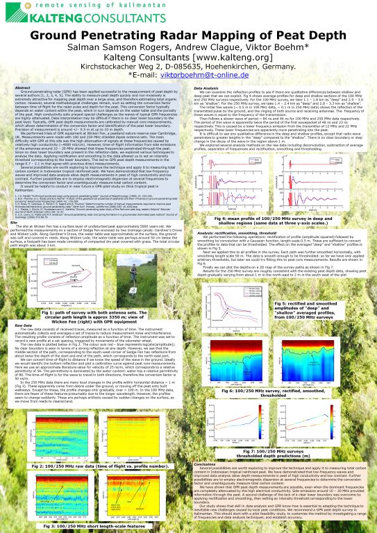
- Ground Penetrating Radar Mapping of Peat ...
- Spectral Variability and Discrimination ...
- Kalteng Consultants Company Profile, Oct
- Visiting of Wetlands International Camp on ...
- Ortho Photo Mosaik von Kelurahan Tumbang Tahai ...
- Ortho-Photo Mosaik from Lake Batu, north of ...
- International Symposium & Workshop on Tropical ...
- The Contribution of CHRIS/PROBA Data for Tropical ...
- Workshop on Spatial Planning and new Remote ...
- Ortho-Photo Generation and Mosaiking of City ...
- Ortho-Photo Mosaik from Kecamatan Bukit Batu, ...
- International Workshop, Wild Fire and Carbon ...
- Planning Group for Kecamatan Bukit Batu gathered ...
- Carbon Storage in the Northern Sabangau Area ...
- Peat Land Topography derived from 30m Resolution ...
- Peat depth, minerals below peat, carbon, fires ...
- Carbon Storage in the Northern Sebangau Area ...
- Peatland Topography DEM-measurements with ...
- Precise Measurements of Peatland Topography and ...
- Environmental Management Study of the Tangkiling ...
- Environmental Field Trials and GIS Image ...
- Land Cover Change on Peatland in Kalimantan ...
- The Impact of Logging and Land Use Change in ...
- Tracks along the Kalimantan Highway from Kasongan ...
- Fires in 2002 monitored on the Landsat-images 14 ...
- The Amount of Carbon released from Peat and ...
- Land use Change in Central Kalimantan over the ...
- Remote Sensing and Aerial Survey of Vegetation ...
- Monitoring land cover and impacts, Remote Sensing ...
- Fire Impacts and Carbon Release on Tropical ...
- Ecological Impact of the one Million Hectare Rice ...
- Land Use Change and (Il)-Legal Logging in Central ...
- Peat fires in Central Kalimantan, Indonesia: Fire ...
- Environmental Helicopter Flight Trails with ...
- Impact of the 1997 Fires on the Peatlands of ...
- Application of Remote Sensing and GIS to monitor ...
- Monitoring of 1997/1998 Fires and Burnt Scars in ...
- Flight survey over the Mega Rice Project and over ...
- Application of Remote Sensing and GIS to survey ...
- Mega Rice Project in Central Kalimantan, ...
- Satellite Images and Aerial Photos from the ...
- The need for better
- Remote Sensing Verification by Aerial Surveys and ...
- NATURAL RESOURCE FUNCTIONS, BIODIVERSITY AND ...
- Excursion to Central Kalimantan, ...
- Satellite Images and Aerial Photography’s from ...
- Symposium of International Peat Society, ...
- Indonesia Travel to Jakarta, Bali and Kalimantan ...
- The Mega Rice Project Central Kalimantan ...
- Land Use Planning and Environmental Monitoring in ...
- Bildverarbeitung von Sensorbildern zur Erstellung ...
- GIS-Workshop, Camp km48 Sangai.
- Monitoring Land Use Change on Tropical Peatland ...
- Seminar on Scientific Implications of the ...
- Report of Ground Truth Campaigns incl. Aerial ...
- Ground and Helicopter verification of Satellite ...
- Environmental Detection from Satellite and ...
- First visit to Central Kalimantan in June 1995, ...
- Environmental Helicopter with Modular Sensor ...
- Remote Sensing with a Thermal Imager on an ...
- The Use of an Environmental Helicopter for the ...
- EUROMAR-SEASTARS a Modular Multi-Sensor System ...
gallery

image gallery
Find a large collection of images from many years of exploration by kalteng-consultants.
History Borneo - Kalimantan · Excursions to peatland 1996 · Mega Rice Project 1999 · 2004 · 2005 · 2006 · 2007 · 2008 · 2009 · 2010 · 2011 · 2012 · 2013 · 2014 · 2015 · 2016-March · 2016-August ·
remote sensing
Ground Penetrating Radar Mapping of Peat Depth-Bogor-9-2012
by Salman Samson Rogers, Andrew Clague, Viktor Böhm*
Kalteng Consultants [www.kalteng.org], Kirchstockacher Weg 2, D-085635, Hoehenkirchen, Germany.
*E-mail: viktorboehm@t-online.de
Poster presentet at the JST-JICA Symposium in Bogor 13-14- Sept 2012
Abstract:
Ground penetrating radar (GPR) has been applied successful to the measurement of peat depth by several authors [1, 2, 3, 4]. The ability to measure peat depth quickly and non-invasively is extremely attractive for mapping peat depth over a large area, and therefore estimating total organic carbon. However, several methodological challenges remain, such as setting the conversion factor between time-of-flight for the radar pulse and depth for the peat. This conversion factor typically depends on water content within the peat, which in turn depends on the water table and the porosity of the peat. High conductivity soils present special challenges as the waves of typical GPR frequencies are highly attenuated. Data interpretation may be difficult if there is no clear lower boundary to the peat layer. Typically, GPR peat depth measurements are calibrated by manual core measurements, which allows determination of the conversion factor and identification of the peat lower boundary. Precision of measurement is around +/– 0.5 m at up to 10 m depth.
We performed trials of GPR equipment at Wicken Fen, a peatland nature reserve near Cambridge, UK. Measurements were made with 100, 250 and 500 MHz shielded dipole antenna sets. The main difficulty with GPR at this site was the high attenuation of signals at these frequencies caused by relatively high conductivity (~4000 S/cm). However, time-of-flight information from side emissions of the antennae around 10 – 50 MHz showed that these frequencies penetrated through the peat. Since no clear lower boundary was present in the reflection data, we explored various techniques to analyse the data. Applying rectification and smoothing to the data allowed us to set an intensity threshold corresponding to the lower boundary. This led to GPR peat depth measurements in the range 0.7 – 2.1 m that agree well with core measurements.
Several possibilities are worth exploring to improve the technique and apply it to measuring total carbon content in Indonesian tropical rainforest peat. We have demonstrated that low-frequency waves and improved data analysis allow depth measurements in peat of high conductivity and low contrast. Further possibilities are to employ electromagnetic dispersion at several frequencies to determine the conversion factor and unambiguously measure total carbon content. It would be helpful to conduct in near future a GPR-pilot-study on thick tropical peat in Kalimantan.
- J.S. Mellett “Profiling of ponds and bogs using ground-penetrating radar” Journal of Paleolimnology (1995) 14: 233-240.
- B.D. Theimer, D.C. Nobes and B.G.Warner “A study of the geoelectrical properties of peatlands and their influence on ground-penetrating radar surveying” Geophysical Prospecting (1994) 42: 179-209.
- E. Rosa, M. Larocque, S. Pellerin, S. Gagné and B. Fournier “Determining the number of manual measurements required to improve peat thickness estimations by ground penetrating radar” Earth Surf. Process. Landforms (2008) DOI: 10.1002/esp
- J. Pladoa, I. Sibulb, M. Mustasaara and A. Jõelehta “Ground-penetrating radar study of the Rahivere peat bog, eastern Estonia” Estonian Journal of Earth Sciences (2011) 60: 31-42
