
projects
Our projects
Large areas of globally important tropical peatland in Southeast Asia are under threat from land clearance, degradation and fire jeopardising their natural functions as reservoirs of biodiversity, carbon stores and hydrological buffers. Local research capability will be strengthened enabling peatland managers to better understand and address the different, interrelated processes operating in tropical peatlands.
- Sambodja Lestari, BOS Foundation in ...
- LiDAR-Data and 30 RGB-Photos from Bukit ...
- RGB Photos from Block C and Sabangau catchment ...
- LiDAR survey 2011 in Central and East Kalimantan ...
- Three Ortho-Photo-Mosaiks taken with ...
- LiDAR and Ortho-Photo Survey in East- and Cenral ...
- LiDAR-Survey in Central Kalimantan for CKPP in ...
- EU - Project: RESTORPEAT-Project: Restoration of ...
- EU - Projekt: STRAPEAT-Seminar / Workshop on the ...
- EU Project - The STRAPEAT Project sponsored by ...
- EU Project: - Natural Resource Functions (Interim ...
- EU Project: - NATURAL RESOURCE FUNCTIONS, ...
- Mega Rice Project - The Benefits of Space-Based ...
- Mega Rice
gallery

image gallery
Find a large collection of images from many years of exploration by kalteng-consultants.
History Borneo - Kalimantan · Excursions to peatland 1996 · Mega Rice Project 1999 · 2004 · 2005 · 2006 · 2007 · 2008 · 2009 · 2010 · 2011 · 2012 · 2013 · 2014 · 2015 · 2016-March · 2016-August ·
projects
Sambodja Lestari, BOS Foundation in East-Kalimantan
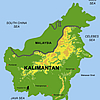
We flown with the helicopter over the Sambodja Lestari area in East-Kalimantn and surveyed the area by LiDAR and Ortho-Photos. Some of the results are shown below. Samboja Lestari reforestation area is located in East Kalimantan. Location of the centre: 116° 59’E, 1° 02’S Vegetation: Plantation forest, many species, age: 1-5 year (2004); Some regenerating forest remnants; Alang-alang (grass); Topography: Undulating - Hilly; Biomass range: 30-150 ton/ha. Height range: 2-15 m. Extent: +/- 3 km in all directions. In Samboja Lestari plantations including teak, gamelina, meranti and fruit trees, and secondary forest plots and areas of alang-alang grass are planted.
The 2000 ha area it acquired had been deforested and was covered in alang-alang grass. The aim was to restore the rainforest and provide a safe haven for rehabilitated orangutans while at the same time providing a source of income for local people. The name of this reserve is the "Samboja Lestari Project", roughly translated as the "everlasting conservation project of the Samboja district".
The reserve is divided into three zones:
- The outer zone consisting of a 100 metre wide ring planted with sugar palm providing income to up to 600 local families and protecting the central area from fire;
- The middle zone which is being reforested with a wide variety of local rainforest trees to provide a permanent wildlife sanctuary;
- An inner zone of about 300 ha with various facilities including smaller forest sanctuaries for specific animals unable to be released as well as the nursery, arboretum and environmental educational facilities.
Since 2001, the land has been planted with more than a million trees covering more than 1000 different species. The alang alang grass was killed as it was shaded out with fast-growing acacia trees which could then be harvested and used in construction. With the growth in the forest, the density and diversity of wildlife returned. So far 137 bird species and nine primate species have been recorded.
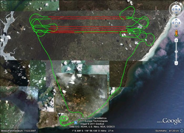
The flight path of the helicopter north of Balikpapan. The turns for the LiDAR- and Ortho-Photo survey is also shown.
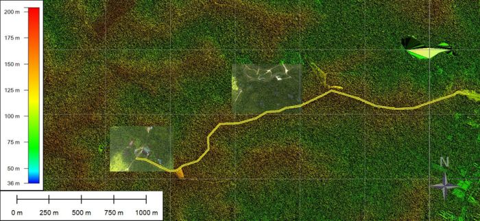
Sambodja Lestari in LiDAR-DSM presentation with two Ortho-Photos from the main BOS building and the Orang Utan island. The yellow line shows the road from the entrance to the building. Monitored on 29. July 2011.
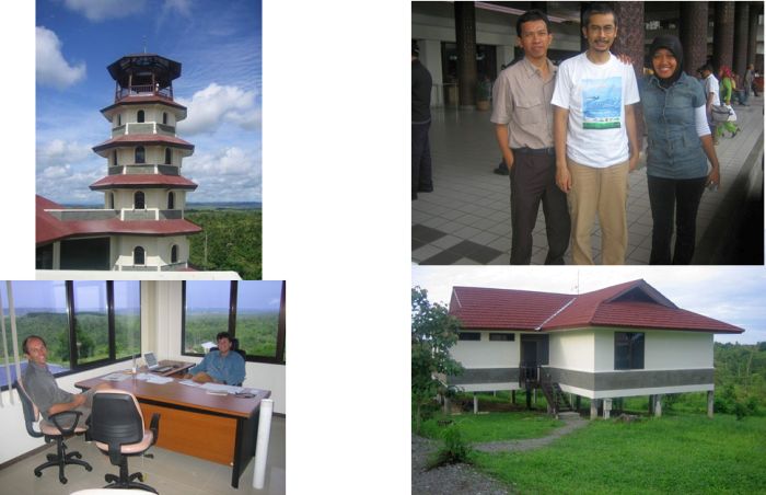
BOS in December 2005 with the tower. Willie Smits, BOS founder in 2001, and Dirk Hoekman from SarVision
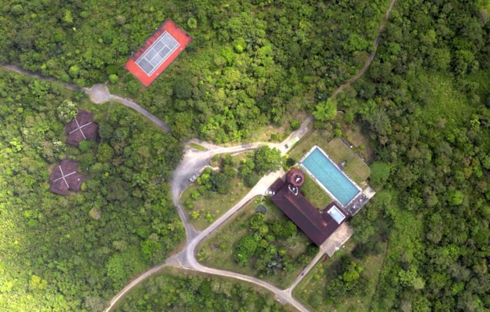
Ortho-Photo from BOS main building taken on 29. July 2011
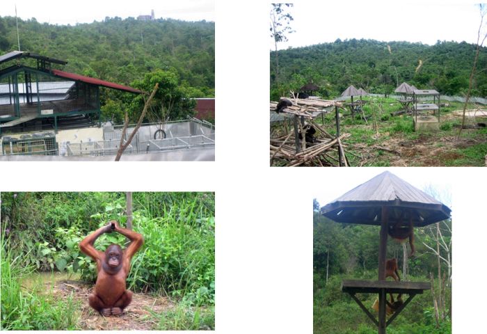
BOS-Orang Utan island and sun bears area in December 2005
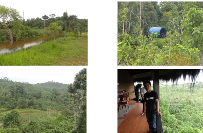
BOS area on 16. July 2011 with Orang Utan island and view from BOS lodge
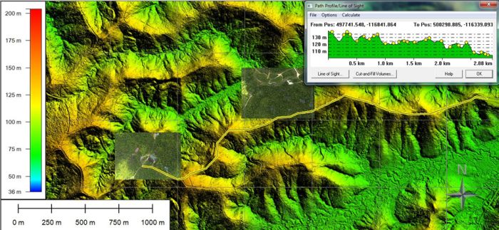
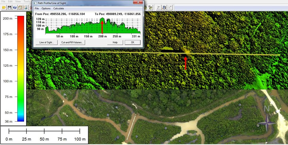
LiDAR-DTM without vegetation, hilly area at BOS area, superimposed by two Ortho-Photos of main building and Orang Utan island. Profile of main road shown in the right upper corner.
LiDAR-DSM, above, and Ortho-Photo, below, from the BOS lodge and the Orang-Utan island. Profile of the forest and BOS lodge shown in the left upper corner.
